
There are 5 other images of this object. See our image rights statement.
Object Timeline
|
|
|
-0001 |
|
|
2010 |
|
|
2014 |
|
|
2015 |
|
|
2024 |
|
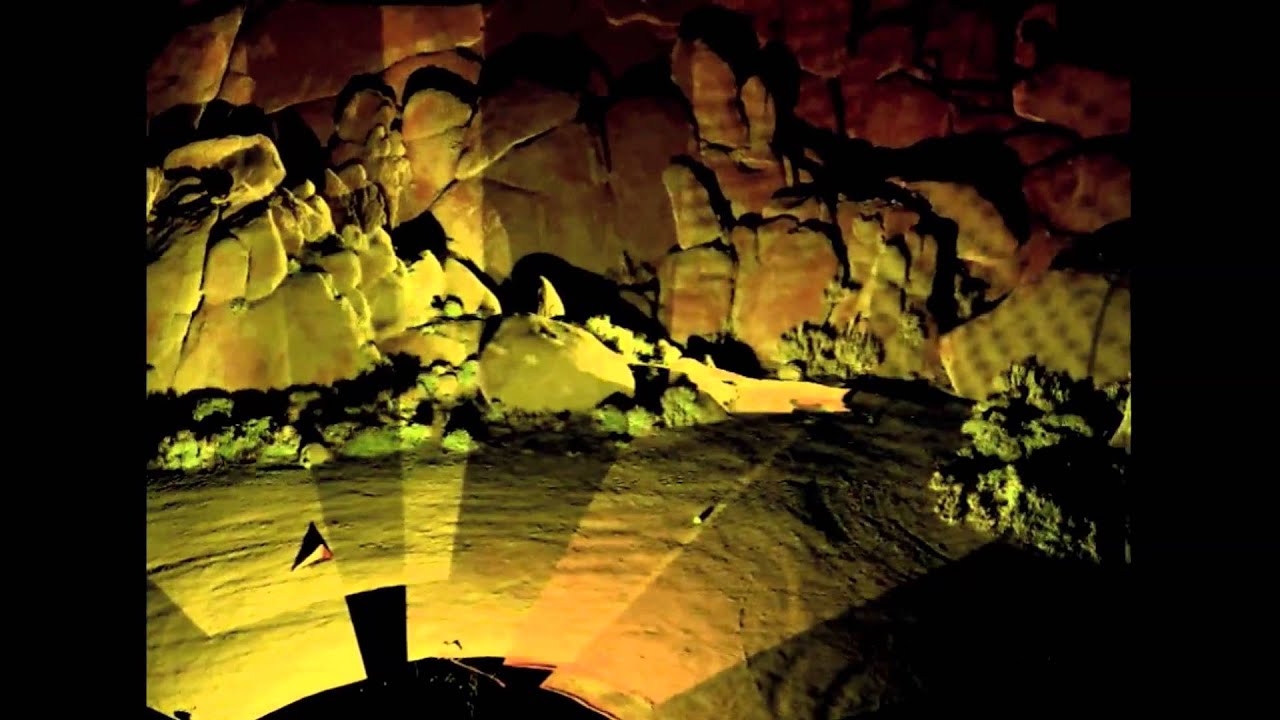
3D Laser Scanner, ScanStation C10
This is a 3D Laser Scanner. It was manufactured by Leica Geosystems Inc.. It is dated 2010. Its medium is compact, pulsed, dual-axis-compensated, very high-speed laser scanner, with survey-grade accuracy, range, and field-of-view; integrated camera and laser plummet.
Lidar—meaning "light" and "radar"—is also known as "3D laser scanning" and "high-definition surveying" (HDS). By moving the Lidar around a site or structure, like a 360-degree panoramic camera, it can automatically capture sites and surfaces in rich detail, accurately measuring (to ¼ inch [.64 cm]) out to a distance of some 1,000 feet (300m). The Lidar automatically combines millions of scanned data into a seamless, full-dome digital image, providing an instant, accurate measurement from any perspective, just by clicking on any two points (or pixels). An entire building, for example, can be scanned, the data compiled to produce a 3D computer model that can be explored virtually. The Lidar’s range of capabilities is vast: in addition to continuous 3D panoramic images, it can render detailed topographic maps of the earth’s surface, survey a forensic crime scene, or peer into archeological sites that are difficult to access.
It is credited Courtesy of Leica Geosystems.
")
- Protractor (USA)
- sheet steel.
- Smithsonian Institution, National Museum of American History, 1977.0460.01.
- 14.2012.66

- Poster, Design Ignites Change
- laser cut wove paper.
- Gift of Marian Bantjes.
- 2013-23-1
")
- Pickett N1010-ES Trig Duplex Demonstration Slide Rule (USA)
- plywood, plexiglass.
- Smithsonian Institution, National Museum of American History, 2010.3095.071.
- 14.2012.67
Our curators have highlighted 1 object that are related to this one.

- Sidewall, LED Wallpaper
- machine-printed silver solution and led lights on paper support.
- Museum purchase from the Members' Acquisitions Fund of Cooper Hewitt....
- 2014-51-1
Its dimensions are
H x W x D: 39.6 x 35.8 x 23.9 cm (15 5/8 x 14 1/8 x 9 3/8 in.)


This object was previously on display as a part of the exhibition Tools: Extending Our Reach.